Cape Town is the oldest city in ‘the Rainbow Nation’ of South Africa and the legislative capital of South Africa housing its National Parliament. It the most popular international tourist destination in South Africa and in Africa as a whole and the largest city and provincial capital of the Western Cape. The City of Cape Town metropolitan municipality has the secondlargest population in South Africa outside Johannesburg.
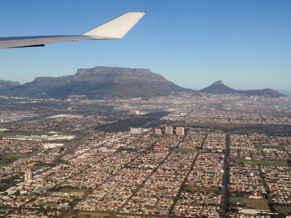
Cape Town from the air: August 2013 Photo Credit: J Walker
It was the first area of European settlement in Southern Africa which may help to explain its pseudonym as the ‘Mother City.’ Its landmarks include its harbour, Table Mountain, Cape Point, Robben Island, now the Robben Island Museum and the Castle of Good Hope housing the South African National Museum of Military History.
The emergence of the town at the Cape was a result of its strategic location, between mountain and sea, on the seatrade route between Europe and Asia. People of many parts of Europe and other parts of the world such as Asia and within South Africa came to the Cape both by choice and by force and this explains the mix of cultures that exists there today.
Khoesan Communities
The earliest communities of the Khoesan were located in the vicinity of the city. All knowledge of these previous inhabitants of the region derives from fossil evidence and rock art (dating from 27000 years ago) in the area.
Further north, groups of hunter-gatherers turned to herding sheep and later pastoralism with cattle. Through migration and cultural transmission, the practice of herding by the San and pastoralism by the Khoikhoi drifted south, and was present along the rivers and coastline north and east of Cape Town at least 2,000 years ago.
Portuguese Exploration
Cape Town had no written history before it was mentioned by Portuguese explorer Bartholomeu Dias who unknowingly sailed around it in 1488 and as explained by UNESCO, the first Europeans to land there were probably the members of (Portuguese) Vasco de Gama’s fleet, who stopped there in 1498 during the Age of Discovery ‘en route’ from Europe to Asia.
European traders bought African gold in exchange for Asian silk and spices. Ottoman Empire expansion disrupted overland trade routes to Europe and explorers were tasked with finding another route around Africa to Asia.
In 1503, Antonio de Saldanha, a Portuguese explorer sailed into Table Bay, mistakenly assuming he had already rounded the Cape. In 1510, Francis de Almeida also sailed there and some of his crew went to a Khoikhoi settlement near Salt River to trade for cattle and sheep, sparking a conflict which ended in victory for the Khoikhoi. Further conflicts with them led the Portuguese avoiding Table Bay.
Dutch Settlement 1652-1795
From 1651 the Vereenigde Oost-Indische Compagnie (Dutch East India Company) (VOC) became aware of the potential of the Cape of Good Hope.
In 1657 Jan van Riebeeck was instructed to set up the colony Riebeeckstad there as a supply stop and to build a fort against the Khoikhoi and other European countries.
Due to the growing need for supplies, the VOC granted some employees freehold lands in the Liesbeeck Valley for them to start farming. They were ordered to sell their produce to it and forbidden to trade with the Khoikhoi.
The first Asian immigrants were sent to the Cape by the Dutch Batavian High Court. They originated the Cape coloured and Cape Malay populations, and brought Islam and its culture there. Their territory expanded and farms were granted by the VOC to a few in an effort to increase food production. The first slaves were brought from from Java and Madagascar in the following year to work on them.
The settlement spread from the shores of Table Bay to other parts of the Cape. Despite farming efforts, settlement at the Cape remained heavily dependent on food supplies from Amsterdam. Van Riebeeck discerned that the land available was insufficient to meet its agricultural demands.
Dutch expansion into areas around Table Bay caused conflicts with the Khoikhoi. Tensions over loss of pastures resulted in the first Khoi-Dutch war, the first of many conflicts between European colonisers and natives.
By the 1660s, their settlement showed growth and European visitors began to refer to it as a town. So much so that in 1661 the VOC complained that Van Riebeeck was establishing a colony and a town, a plan it had so far discouraged.
By the 1670s the VOC had committed itself to establishing a permanent settlement at the Cape. However, the growing influence of the British and the French who also had interests in the Indian Ocean posed a threat to the Dutch.
When war broke out between the Netherlands against Britain and France the VOC declared itself the rightful owner of the Cape including Table Bay, Houtbay and Saldanha Bay.
A colony was constructed in what is known as the Cape Dutch style. The Dutch were joined in 1688 by French Huguenots until 1795. Protestant Huguenots had fled from anti-persecution in France to the Netherlands, where the VOC offered them passage to the Cape as well as farmland. The Huguenots brought wine production experience and their strong cultural roots.
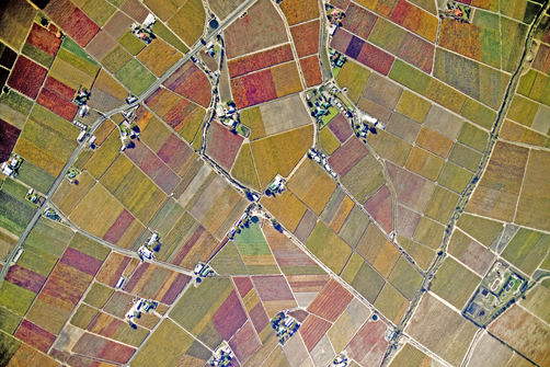
Cape Vineyards [Image Source]
The order to set up a permanent settlement was an attempt by the Dutch to exclude the British.

1750 Bellin Plan of Cape Town [Image Source]

1775 J Schumacher[Image Source]
In 1780, France and Great Britain then went to war. The Netherlands entered the war between them on the French side, as a small garrison of French troops had been sent to the Cape to protect the Netherlands against the British.

1785 Plan of Cape Town [Image Source]
British Occupation 1795-1803
Determined to prevent the Cape from passing to France after it had occupied the Netherlands and formed the Dutch Batavian Republic, the British took it in 1795.
They viewed this occupation as a temporary measure meant to last until the defeat of the French. However on doing so they immediately announced the beginning of free trade, including slaves. Like the VOC had, the British East India Company also used it as a supply and refreshment base.
Dutch Occupation 1803-1806
In 1802/3 with the Treaty of Amiens, the British handed it back to the newly installed Dutch Batavian government.
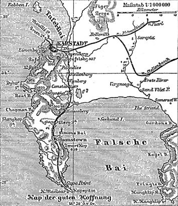
1800s map of Cape Town [Image Source]
British Settlement 1806-1961
When the Napoleonic War broke out for the second time, the British once again feared the city could fall into the hands of the French so they attacked it and retook it from the Dutch in 1806. From then on there were major developments, the start of Cape Town as a city in its own right. Taps and iron pipes were installed along major streets.
At the Treaty of Vienna the British acquired the Cape permanently and became known as the Cape Colony. The city remained in their hands and became a crown colony. It experienced major changes under the British occupation and became its capital.
British immigrants arrived as merchants, some founded the Commercial Exchange, more British officials were appointed and many young men engaged in trades such as blacksmiths. English became increasingly used.
The war between France and England ended with a British victory. The British drew up the Anglo-Dutch Treaty whereby pieces of real estate were exchanged for money by various countries.
The British saw the control of it as vital to their ability to maintain their command in India. The Dutch garrison was replaced by English soldiers. The Dutch agreed with the condition that they be allowed to continue to use it for repairs and refreshment. The vagrancy and pass laws of 1809 were repealed in 1829.
The temporary economic boom of the 1830s laid the foundation for its commercial and financial infrastructure. As in the rest of the British Empire, slaves were emancipated in 1834. This led to the establishment of the Bo-Kaap, by a Muslim community after being freed.
Many British arrivals built residences outside town in areas previously occupied by farms and gardens. Not all British immigrants that came were those that sought fortune. British children and other workers were brought to work as indentured labour for local British employees to rid England and other crown colonies of slum.
The growth of British influence bred resentment by the Dutch. As a consequence, descendants of Dutch settlers left it, migrating eastward and north eastward in search of new land in die Groot Trek, began in 1836, founding of Afrikaaner Republics away from British control.
Further political development occurred when the Cape Town Municipality was formed. Ensuing political developments saw gradual moves towards independence from Britain and a degree of political inclusiveness. The Cape Colony elected its first parliament, and after political struggle, this was followed by responsible government. A period of strong economic growth and social development ensued, with a rapid expansion of the Cape Government Railways and other infrastructure, connecting the city to the Cape’s vast interior.
The discovery and subsequent exploitation of diamonds in Griqualand West and gold in led to rapid change. As Johannesburg grew from the Witwatersrand Gold Rush, it lost its position as the single dominant city in the region but as the primary port it increased trade to the region was beneficial to it.
The mineral wealth generated in this period laid the foundation for an industrialised society. This period marked the first incident of segregation in the city and led to the mineral revolution in South Africa, setting the stage for the Anglo-Boer War war between the British and the Afrikaaner republics. At the end of this war all four colonies were placed under one flag.
Union of South Africa 1914
All four colonies were then united in the Union of South Africa making South Africa a self governing nation but still under the British control. Cape Town became the legislative capital of the Union.
In the 1940s British influence was weakened even though English still remained the key language.
The townships of the Cape Flats developed. In 1948, the National Party stood for election on its policy of racial segregation, later known as apartheid.
Under apartheid, it was considered a “coloured labour preference area”, to the exclusion of Xhosa Black Africans.
During the 1950s, in an aim to prevent Africans flooding into he city, no African was permitted to settle permanently west of a line near Fish River, over 1000km from it.
Independence
In 1961 the four unified colonies became the Republic of South Africa.
By 1966, the once-vibrant District Six area was bulldozed and declared a white-only area. This resulted in whole communities being uprooted and relocated to the Cape Flats and Lavender Hill. African townships were set up as dormitories to provide labour for white Cape Town with no facilities and no real hub. Men-only hostels were at the root of many social problems. During the 1970s and 1980s the government tried to remove largely Xhosa squatter camps, such as Crossroads built from makeshift iron, cardboard and plastic sheeting but they are now a permanent feature of the Cape Flats.
Today, the government is making attempts to improve conditions in the shantytowns by introducing electricity, running water, improved roads and sanitation, as well as building tiny brick houses to replace the shacks.
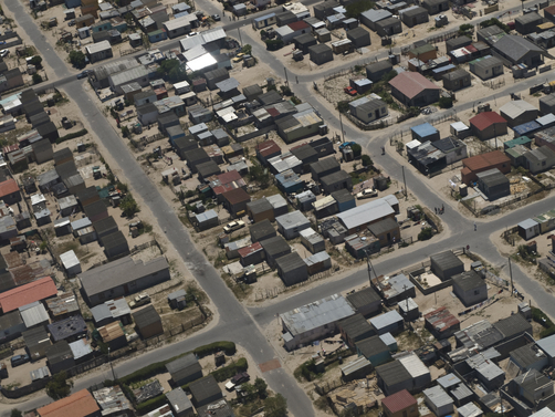
Cape Flats suburb [Image Source]
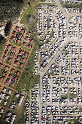
Cape Town low-cost housing suburb [Image Source]
1990 until today.
Hours after being released from prison on 11 February 1990, Nelson Mandela made his first public speech in decades from the balcony of the Cape Town City Hall, now a dedicated cultural venue, heralding the beginning of a new post-apartheid era for South Africa.
Today the city’s urban geography is influenced by the contours of Table Mountain, the Durbanville Hills, and the expansive lowland region known as the Cape Flats. These geographic features divide the city into several commonly known suburbs, many of these communities developed historically together and share common language and cultural attributes including: City Bowl, Atlantic Seaboard, West Coast, Northern Suburbs, Southern Suburbs, South Peninsula, Eastern Suburbs, Cape Flats and Helderberg.
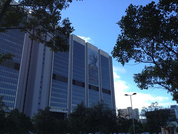
In 2010 the City hosted the FIFA 2010 Soccer world cup. Since then the city is experiencing an economic and construction boom that seeks to enable, engage and provide for all sectors of its society, improved healthcare facilities being an on-going concern. The city was named the World Design Capital for 2014 by the International Council of Societies of Industrial Design, creating a new opportunity for the city and its many communities to reinvent, present and attract itself and themselves, to the rest of the world.

Author: Mary Bon
Mary is a RIBA accredited architectural researcher, with previous international experience in architectural practice. She has proven research and writing experience for both established clients and innovative start-ups in the construction industry worldwide. She is now based in France and orientated towards bridging the gap between landscape and architecture whilst supporting the causes of local, national and international built and natural heritage